Geophysical Surveys
In the petroleum industry, geophysical data play an important role in oil and gas exploration and production. Deciding where to drill may be as much of an art as it is a science. Since most of the petroleum deposits are buried deep below the surface, geophysicists find oil and gas by building a clear picture of what is below the Earth's surface.
Geophysical techniques used for petroleum exploration utilize equipment to measure such things as: electrical currents, gravitational and magnetic anomalies, heat flow, geochemical relationships, and density variations from deep within the earth. Each technique records a different set of characteristics which can be used to locate hydrocarbons beneath the surface of the earth.
|
Seismic Surveys
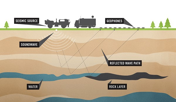
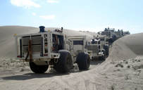
Sound waves are bounced off underground rock formations and the waves that reflect back to the surface are captured by recording sensors for later analysis. Analysing the time the waves take to return provides valuable information about rock types and possible gases or fluids in rock formations. This is similar to the use of ultrasound in medicine. Onshore operations usually use specialised trucks that carry a heavy plate that is vibrated to generate a seismic signal. In offshore operations, a specialised vessel tows a “seismic streamer”, or a collection of cables with seismic sources and hydrophones attached. The seismic sources use compressed air to produce acoustic energy. The hydrophones capture the returning sound waves for later analysis. |
|
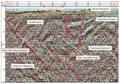
3D Seismic Survey
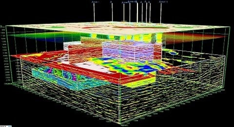
The most sophisticated seismic surveys are three-dimensional (3-D). The recorded data is processed by computer and the results are a detailed, 3-D picture of the formations and structures below the surface. The process is expensive, on the order of $30,000 per mile (Satterwhite, pers comm). But drilling a well can cost multiple millions of dollars, so time and money spent on accurate seismic surveys can be a good investment since it helps locate prospects and minimize dry holes. Moreover, this method has proven effective in predicting drilling hazards such as faults and overpressure.In general, seismic surveys can be carried out without disturbing people or damaging the environment, whether they are being conducted on land or water. It is a primary tool used by exploration geologists to locate hydrocarbon. |
|
The Four Stages of Seismic Exploration
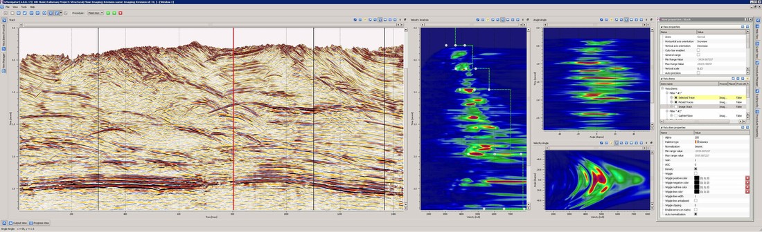
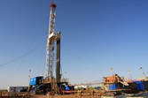
1. Seismic Acquisition To produce a seismic image of the subsurface, a seismic source must be generated and the resulting reflection data recorded by a field crew. In this way, land and marine seismic data is created and recorded all over the world. 2. Seismic Processing Next the data must be processed, where the raw data is put through many complex procedures using powerful computers and finally a seismic section is produced. 3. Seismic Interpretation Making sense of the seismic image, identifying and mapping geological structures that can act as oil traps is the final stage of the seismic process. 4. Exploration Drilling If the results of the interpretation seem favourable, then an exploration borehole will be drilled. A well in a previously unexplored area is called a wildcat. |
Reference
- http://www.dnr.louisiana.gov/assets/TAD/education/BGBB/5/techniques.html
- http://www.srk.com/en/our-services/petroleum/exploration/ww-geophysics
- https://www.appea.com.au/oil-gas-explained/operation/seismic-surveys/
- http://www.sub-surfrocks.co.uk/?page_id=66
Written by
Napatr Wongsinphaiboon
Edited by
Nipaporn Poonsawat
Napatr Wongsinphaiboon
Edited by
Nipaporn Poonsawat
